Maps Digitization — Proof of Concept
Technical prototype portfolio — demonstration environment
Runs against the bundled sample map and its bundled control points below, one deliberately a few meters off. No AI step — a real least-squares affine transform is fit from the bundled control points (real pixel position ↔ real longitude/latitude pairs), then independently re-checked against those same points, converted into a real, standard world file GIS software reads directly, and used to convert the bundled POI pixel positions into real GeoJSON point coordinates. Do not submit personal, confidential or client-owned maps — this public demo only runs the bundled sample below. Contact Chrisian to discuss a controlled evaluation.
Bundled sample map
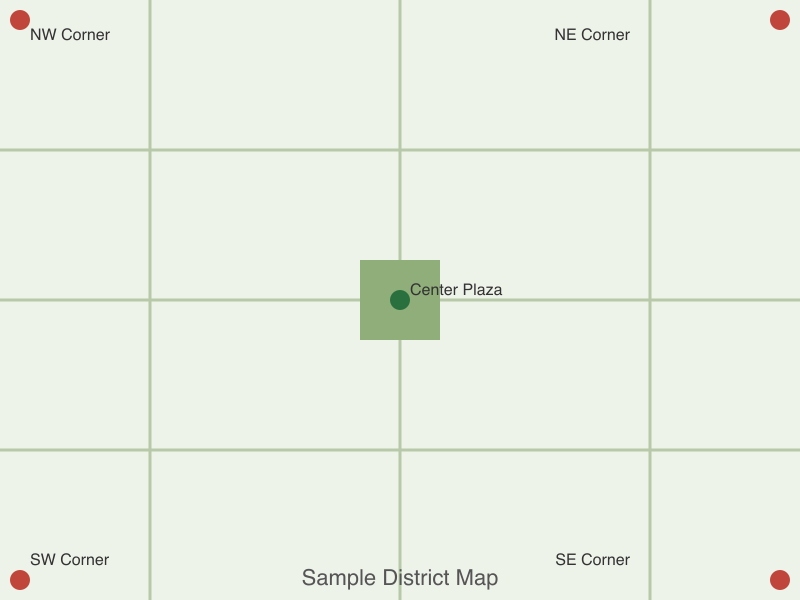
sample-district-map.png
Bundled control points (3+)
One per line: label, pixelX, pixelY, longitude, latitude
NW Corner, 20, 20, -122.4191727, 37.7747191
NE Corner, 780, 20, -122.4105353, 37.7747191
SE Corner, 780, 580, -122.4105353, 37.7696530
SW Corner, 20, 580, -122.4191727, 37.7696530
Center Plaza, 400, 300, -122.4148540, 37.7723361
Bundled points of interest
One per line: name, pixelX, pixelY
North intersection, 150, 150
South intersection, 650, 450
Residual threshold: 10m — a control point farther than this from the fitted transform's own prediction is flagged.